Sep 19 day 19 Pakiri Camp to Dome Cafe (Highway 1) 26 km 6:45-4:00
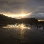
The most physically rigorous day since the Raetea Forest. Started out walking straight up a steep pasture– no trail, just knee high grass and the occasional post painted white at the top. Finally got to the top, great views but completely soaked. Followed a fence line up and down with mud so deep, it sucked your shoes off. Path was narrow and crowded by gorse which at some point tore off my hat which was hooked to my pack (I was not about to go back to look for it). It’s cute when Pooh or Tigger fall into the gorse, they don’t bleed. The rest of the day was mud and root hiking, lots of elevation change, some good views but also much rain. High point was the end when I got to the Dome Cafe by four — it closes at five– had an early dinner and a couple Macs lagers which tasted exactly like the beer Dad used to drink when I was a kid. They comped me some fries, then gave me a ride to the “sheeps world” camp ground– a place straight out of some weird reality show. Was cold and wet so I opted for bunk, which turned out to be in an old caravan– was cool, sort of. Tomorrow not looking easy but not as bad as today. Gunna sleep well tonight.
Day 22
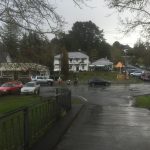
Sep 22 day 22 Stillwater to Auckland YHA 33 km 6:15- 4:00 So at 7:09 this morning I was trying to ford the Okura River. I did everything right– arrived at the ford point at exactly low tide, tried 4 different places. Each time I’d get about 20 meters out and the water would get […]
Day 21
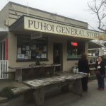
Sep 21 day 21 Puhoi to Stillwater. 32 km 8:00-3:30 (because of high tides, some road walking probably shortened the actual distance) Today started with another generous act. Two days ago, when I stopped at the Dome Cafe for an early dinner, wet, covered in mud, I ordered food and a beer. When the woman […]
Day 20
Sep 20 day 20 dome Cafe to Puhoi 27 km 8:30-3:00 Got a bit of a late start because I walked up from the Sheep World Campgrounds, to the Dome Cafe for another meal and some great conversation with the couple who run it. Both so kind and peaceful. Had delicious Eggs Benedict and coffee […]

Day 18
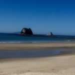
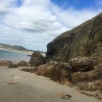
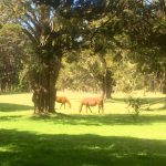
Sep 18 day 18 Mangawhai Village to Pakiri Camp 23 km 7:45-1:00 Short day, resting for what looks to be a difficult couple of days ahead. Pretty much a two surface hike–road to beach, then beach to the end (a brief up and over a point at Te Arai). Started out in the pouring rain, […]
Day 17
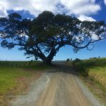
Sep 17 day 17 Waipu Cove to Mangawhai Village (Mangawhai Camp) 28 km 7:30-2:30 Very straightforward day. Woke to clear blue skies, got on trail fairly early, had to backtrack to the turn which took me up through a subdivision. They are building lots of upscale houses on the ridges overlooking the bays and islands. […]
Hiking Time
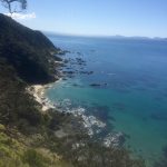
Hiking Time Portions of the Te Araroa require hitching a ride on a boat. Opua to Waikare is an extra 25km if you don’t go by water. I opted for the boat not just out of laziness, but also because I wanted a different view– oyster beds, derelict boats, grand waterfront houses, and old shanties–but […]
Day 16
Sep 16 day 16 McLeod Bay to Waipu Cove 30 km. 8:30- 3:00 (part by boat) Today started much better. A sleepless night near a road–once again cars kept me up much of the night, but on rising, packing up, I noticed the The Deck cafe, which had been closed last night, was well lit, […]
Day 15
Sep 15 day 15 Pataua South to McLeod Bay 29 km 7:15-4:00 A day of different surfaces and perspectives. Was supposed to start out by traversing a mud flat, but would have had to wait until noon, so I took the long way around the estuary on a road. Then up and over Kauri Mountain […]
Day 14
Sep 14 day 14 Ngunguru Village to Pataua South 32 km 8:45-4:00 Not a particularly eventful day, though the weather was perfect, nearly cloudless. First half was a long road walk out of Ngunguru past the Hugh Crawford Reserve– about 15 km. not a lot of traffic and the countryside was pretty, but also boring. […]