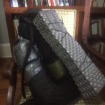
Inventory
Inventory I remember as a child marveling at a Boy Scout mess kit. Inside a green canvas cover embossed with the Scout emblem was a shiny aluminum flying saucer. Loosening wingnut at the end of two extended metal tabs let me rotate a metal strap away and lift off the top half disk which magically […]
Day 30
Sep 30 day 30 Rangiriri to Ngaruawahia 34 km 7:00-4:00 So I broke my resolution to slow down a bit. Started morning in thick fog, wore my headlamp to be seen through the construction site, but after crossing the Waikota I was more or less in the country with a straight shot down to Huntly. […]
Day 29
Sep 29 day 29 Mercer to Rangiriri 25 km 9:15-3:15 Woke early, looked out on a cold, very foggy landscape, rolled over in my warm bed and slept more. After packing I went over to the Pokeno Bacon Diner. They serve filter coffee (first I’ve had since arriving) and lots of bacon dishes (including an […]
Day 28
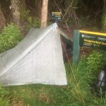
Sep 28 day 28 stealth camp on Mangatawhiri track to Mercer 23 km 7:45-2:30 Slept well and long, but had a hard time getting cranked up for hike as the rain showers kept rolling through while I marveled at how well my tent kept me dry and comfortable. Also I was dreading the climb and […]
Day 27
Sep 27 day 27 Clevedon to stealth camp on Mangatawhiri track 31 km 9:00-6:00 What started out peaceful, turned pretty hard, though I really don’t know why. Slept in a little, plus the time changed, so I got a late start on both my time and clock time. Did have coffee at the Clevedon Cafe […]
Day 26
Sep 26 day 26 Auckland Airport to campground at Clevedon Village 34 km 7:30-3:00 Slept in a bit, had coffee at Jamaica Blue– good coffee– then set out for what would be the most boring day almost (saved by the end). Had about 28 kilometers that was pretty much all sidewalk walking. The only bright […]
Day 25
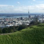
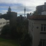
Sep 25 day 25 Auckland to Auckland Airport 33 km 8:15-3:30 My sense is that the TA route through Auckland was designed on a dart board, but I did get to climb Mt. Eden and One Tree Hill, walk through some cool neighborhoods, and finally out to the airport– not your most scenic place. Finally […]
Day 24
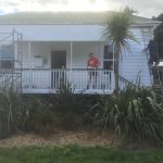
Sep 24 day 24 Auckland 0 km, Zero Day A day much like yesterday. Had to check out of the YHA hostel as they were booked, but found a luxury hotel room just down the block for the same cost. Hotels.com came through on that. And Ubertec also delivered, getting my new phone in and […]
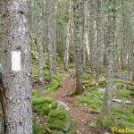
Footpaths
Footpaths First writing is done by feet. When we walk, we make marks and we make meaning. A path is deep writing. It is a material surface that over time becomes worn and accommodating, but it is also indexical, pointing out a direction–actually two. In addition, paths are communal: formed and maintained by community while at […]
Day 23
Sep 23 day 23 Auckland 0 km, Zero Day Was strange waking and not walking. Instead I strolled to a coffee shop for a day of healing and rest. Given all the isolation of the last weeks, for some reason, I still want quiet and privacy here. Just peace without motion. I’ve started to put […]