Walking Home

reveries of an amateur long-distance hiker

Walking to Cape Wrath, Day 3 May 13, 2022

May 14th, 2022

Walking to Cape Wrath, Day 3 May 13, 2022

Much as I like to celebrate life on the open road, some days fall into the category “no fun.” I’ve already heard the term “Scottish weather” countless times, but today even the most grizzled Scot owned it was some wind. Guess I should have been suspicious when the weather just posted an image ?, particularly since today’s hike was billed as a beautiful trek along the ridge line.

Of course it was not all brutality, the morning out of Melrose included more beautiful wandering along the River Tweed. After a half-Scottish breakfast (I declined the tomatoes and beans, and they didn’t offer blood pudding), I wandered down Main Street, picking up some oat cakes and fruit as today’s route crosses no towns. I soon passed the rugby field— clearly the favorite sport in this region—heading toward the river with its fishermen and dog walkers. After a bit, climbing up the river bank brought Skirmish Hill, a place where in 1526 various Scottish nobles (including James V) decided to kill each other. At one point later I had a wonderful sense of deja vu as the path opened out onto the Tweedbank train station, the spot where, on my first day, I caught the bus to Kelso on the way to Kirk Yetholm. Then there was a lot of walking through sheep fields and the edges of a large town (Galashiels) until finally breaking out into the true countryside. There were pastured hills and woods with the forest floor carpeted with Scots bluebells. Near midday, I began the long climb out of the valley to a high hill topped by the Three Brethren— three large stone cairns next to a trig point looming over a broad landscape.

That’s when the unfun began. Initially it was just like much of the ridge line I’ve been in so far— far below stonewalled sheep and cattle fields and close cropped pasture, and closer by, heather about to bloom. But on the distant hills were forests, not a Sherwood Forest full of oaks and merry men, but instead a plantation. I was crossing land owned by the Duke of Buccleuch, apparently one of the largest landholders in all of the UK. While much of the land was open, vast tracts were planted up in nice clean rows of pine—one of those monocultural pine plantations derided by environmentalists. Of course Scottish tree plantations date back at least to the Earl of Atholl whose land on the slopes of the Cairngorms became test ground for both mono and poly arboriculture. But here we are talking straight-up industrial tree farming.

And the wind the weather people predicted hit with full fury. I had passed some hikers who were heading east (the wind at their backs)— they looked on me with pity, knowing what an afternoon I was in for. I’ve been in worse (that would have been an attempt at the Tongariro Crossing in 2015: https://walkinghome.lmc.gatech.edu/te-araroa-walking-south-with-the-spring/day-43/), but today did involve some staggering wind. Thankfully all my equipment (including those titanium knees) performed. It was straight up exposed ridge hiking in the teeth of gale force wind, the only respite was in the lee of one of the Duke of Buccleuch’s tree crops (one bright spot was a stretch on an old drove road, making me glad I had read A.R.B Haldane’s Drove Roads of Scotland).

On entering the forests, it became clear what I was experiencing was the merest trifle. Massive old trees, whole swaths of timber were down, almost as if some giant child had brushed their hand across the landscape, flattening arbitrarily tree after tree. I was inspecting first-hand the handiwork of Storm Arwen, an extra-tropical cyclone that, between 25–27 November 2021, devastated the woods across the UK, with nearly 100 mph winds hammering this corner of the world. The only comparable experience I have was the derecho that smashed into the mountains of Virginia in 2012. There the hail was as large as I’ve ever seen and thousands of old growth was leveled (https://roanoke.com/archive/volunteers-clearing-the-appalachian-trail-of-blown-down-trees/article_15302054-c1b2-59fe-9bd7-fd977ac1bb76.html).


Fortunately by mid-afternoon I was descending to Traquair (the official endpoint of today’s trek) and in a light rain I made my way to the Tweedside Caravan Park in Innerleithen where, after waiting in a pub for the rain to abate, I pitched my tent and then had an amazing meal (duck confit) at the Traquair Arms (a place well worth a visit). Very happy tomorrow will be a short day.

T. Hugh Crawford

Walking to Cape Wrath, Day 2 May 12, 2022

May 13th, 2022

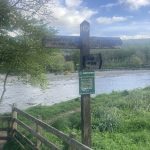
Walking to Cape Wrath, Day 2 May 12, 2022

When hiking the Appalachian trail, I tended to obsess over wet feet (an unfortunate obsession to have, particularly in Vermont). The trail is so brutal, it beats your feet to death, so factors like wet feet can exacerbate an already fragile constitution. On New Zealand’s Te Araroa, I quickly learned that wet feet were a requirement. On the North Island, many sections of the great path are actually routed down the middle of a stream. I remember on the South Island crossing Waiau Pass, running down a melting glacier to find a place to tent in a wild woods. There I built a fire (something I rarely do) and dutifully dried my shoes and socks. The next morning, on hiking out all of 20 yards, I had to ford a waist deep icy stream. So much for dry feet. (https://walkinghome.lmc.gatech.edu/te-araroa-walking-south-with-the-spring/day-78/).


While not nearly as dramatic as running down a glacier from the highest point on the Te Araroa, I did find myself reliving the old wet-feet anxiety when, on heading out from the Lillardsedge campground after a fairly heavy midnight rain, I had to find a way to cross a field to regain the trail. A tree line which was probably the remnants of an old hedgerow provided a guide and a path, but of course it was completely overgrown with coarse grass and within seconds my feet were sloshing in my shoes. My Appalachian trail spirit screamed “turn around” in one ear, and my Te Araroa sprit just said “sweet as.”

I crossed the field without much incident beyond moisture and found a first-rate trail winding through a lane of old beech (with the highway humming in the background). It turned quickly into a pleasant wander through fields, hedgerows, small towns with beautiful old chapels, and of course Welly-shod dog walkers— just the experience I expected. There were parts of that woods walk that reminded me of the eastern mountains of the US, except the dominant trees were beech rather than oak or poplar. You have to love a good beech forest.

The afternoon was spent following the River Tweed, with swans, fly fishermen, and carpets of wildflowers (dominated by Ramsons). Late afternoon took me through the Eildons, three peaks made famous in Scott’s “Lay of the Last Minstral.” The path went up through the saddle, so I was tempted to summit, but as per the last few days, mid-afternoon brings mist and rain, so I opted for the descent into Melrose, a beautiful town with a ruined Abbey.

I checked into the Station Hotel, late lunched on a haggis burger, visited the abbey (which is where Robert the Bruce’s heart is buried),  wandered the town, finally boarding The Ship—another classic pub, this time filled with football fans waiting for the game to commence. Still adjusting to time, weather, and pure physical exhaustion, I found myself returning to the Station Hotel early for some luxurious sleep on a real bed (no tent and thin sleeping pad for me): a day well spent.


T. Hugh Crawford

Walking to Cape Wrath Day 1, May 11, 2022

May 12th, 2022

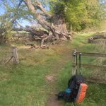
Walking to Cape Wrath day 1, May 11, 2022

In 2014 I walked the Pennine Way, finishing at Kirk Yetholm just across the Scottish border. What I remembered most about that hike was wandering the Yorkshire Dales and the crazy weather up on the ridges, but the last part was in the Cheviots, a different topography and sensibility. Obviously settled by farmers for millennia, the granite mountains are humped, rounded hills covered with close-cropped grass— the work of sheep over centuries. That world doesn’t change at the border, so today was spent climbing cheviot humps, covered with grass and sheep— it’s lambing season— and rimmed with gorse (loved by Eeyore, enjoyed at a distance by walkers, but a brutally difficult plant to manage).

Technically I started the Scottish National trail yesterday at Kirk Yetholm as I left the village to stay in Town Yetholm (1/4 mile) at a campground. I set up my new ZPacks duplex tent— my original Soloplex lasted through the Te Araroa, Nepal, the Camino, TransSwiss, Laugavegur, Tasmania, and the Benton Mackaye before finally giving up the ghost. I’m loving the replacement. The wind was brutal even though I was pitched in the lee of the shower house, but I slept like the dead, causing a late start.

That first night in Town Yetholm I stopped at The Plough—the town pub and a classic rural establishment. Late afternoon a crowd of locals had gathered, picking up on the stories they probably had been telling the day before— lots of good natured ribbing which they soon directed toward me. My ear not yet attuned to the accent, I missed half the comments, but from their demeanor, none of the insults were Ill-intended. And of course there was the obligatory large dog sleeping in front of the fire.

I was reminded how close the community is in rural pubs—composed of locals and the many walkers who fill the paths all over the country. They returned from their walks and burst through the pub door. You can see the wind still in their faces. It takes a moment for the outdoors to leave them, then they set their inside faces, warm from the day’s walk and the close air of the pub. I half listened while eating bangers and mash, soon dozing off, so rousting myself like a dog from the fire, I made my way back to the campsite huddled against a strong wind.

Before setting off in the morning, I stopped at the local post office/convenience store where I got McVitties Digestif crackers (fundamental hiking food) and some cheese and crackers. While sipping my coffee I was greeted by a stream of farmers stopping by to pick up a newspaper before returning to the fields. Even the gruffest were quick with a greeting and smile. Just before I left, the woman running the store stopped by the front door. We were looking out over the Cheviots with their gorse lit up by the morning sun. She asked where I was going, smiling approvingly when I said I was heading up to the hills. We talked the weather and she explained how much of this area have their own micro-climates—that in the winter one village will get snow and the next won’t. Then she looked up to the hills declaring it a wonderful place to live— something for her that was simple fact.

The morning’s walk was a long slow climb out of the valley, occasionally crossing the river and fields of sheep—it’s lambing season, so sometimes a wide berth was necessary. Late morning the trail worked up to the top of the ridge with the wind continuing to howl.  Most walkers on this section are doing the St Cuthbert, and they start from the west to hike to the sea. I passed many of them, all with the wind at their backs, while I plowed ahead face first. Sometime later in the morning I crossed Wideopen Hill. Measuring 1207’, it is the highest peak on the St. Cuthbert Way, which just is a reminder this is part of the Lowlands. By midday I was in Morebattle eating a big lunch, and then set off for a pretty difficult afternoon— first some nice forest walking, mostly in beech and birch woods. There are no accommodations at the standard endpoint (and unlike most distance walkers here, I’m not using a baggage and van service), so I needed to push forward, making a long day even longer, finally landing at the Lillardsedge campground around 6:30– too long for a first day trekking. Still, a nice place and I slept once again like the dead

T. Hugh Crawford